Randonnée Marche La Ciotat - Cap Canaille - Photo
 DanielROLLET
DanielROLLET

Utilisateur

© OpenStreetMap contributors
Longueur
Longueur
10,2 km
Altitude max
Altitude max
381 m
Dénivelé positif
Dénivelé positif
450 m
Km-Effort
Km-Effort  
16,2 km
Altitude min
Altitude min
0 m
Dénivelé négatif
Dénivelé négatif
454 m
Boucle
Boucle
Oui
Date de création :
2015-06-25 00:00:00.0
Dernière modification :
2015-06-25 00:00:00.0

(1 Avis)

Marche
Marche
4h00
Difficulté : Moyen

Scannez ce code QR pour ouvrir la randonnée dans l'application SityTrail

Application GPS de randonnée GRATUITE

Logo SityTrail SityTrail

IGN / Instituts géographiques

Télécharger SityTrail sur l'App Store Télécharger SityTrail sur Google Play

Logo SityTrail SityTrail World

Le monde est à vous

Télécharger SityTrail sur l'App Store Télécharger SityTrail sur Google Play Télécharger SityTrail sur Huawei AppGallery

À propos

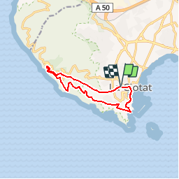
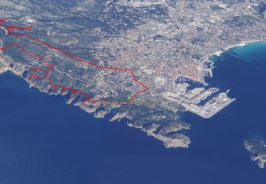
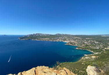
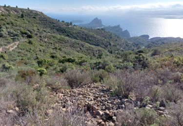
Randonnée Marche de 10,2 km à découvrir à Provence-Alpes-Côte d'Azur, Bouches-du-Rhône, La Ciotat. Cette randonnée est proposée par DanielROLLET.

Description

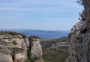
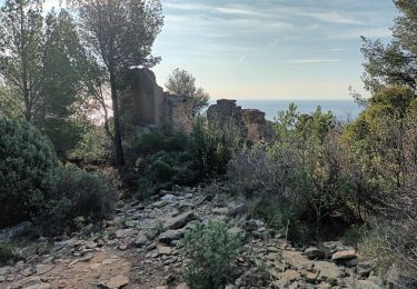
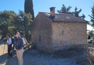
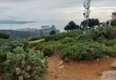
Départ parking La Pétanque (face cimetière) à La Ciotat, montée à la cote 394. Retour par le télégraphe, le parc du Mugel et le port.

Profil altimétrique

Localisation

Pays :
France
Région :
Provence-Alpes-Côte d'Azur
Département/Province :
Bouches-du-Rhône
Commune :
La Ciotat
Localité :
Unknown
Départ:(Dec)
Départ:(UTM)
711437 ; 4783655 (31T) N.

Commentaires

Veuillez vous connecter pour laisser un commentaire ou une note


Randonnées à proximité

Randonnée Marche La Ciotat - La Ciotat - Chapelle Ste Anne - Ruines villas - Semaphore - Bau Rous - Pont naturel - Dent du chat - Photo
Marche
GUIDE
affinetataille

Marche

Difficile
(1)
La Ciotat, Provence-Alpes-Côte d'Azur, Bouches-du-Rhône, France
12,1 km | 19,9 km-effort
7h 30min
Oui
Randonnée Marche La Ciotat - la ciotat - Photo
Marche
Berrangerannick

Marche

Très facile
(1)
La Ciotat, Provence-Alpes-Côte d'Azur, Bouches-du-Rhône, France
6,2 km | 9,3 km-effort
3h 21min
Oui
Randonnée Marche Cassis - les calanques de Cassis - Photo
Marche
th.feur

Marche

Moyen
(1)
Cassis, Provence-Alpes-Côte d'Azur, Bouches-du-Rhône, France
15,9 km | 23 km-effort
6h 2min
Non
Randonnée sport Ceyreste - CEYRESTE MP 04.24 - Photo
sport
michelpaulin

sport

Très facile
Ceyreste, Provence-Alpes-Côte d'Azur, Bouches-du-Rhône, France
11,5 km | 17,7 km-effort
Inconnu
Non
Randonnée Marche La Ciotat - Sémaphore bec de l'Aigle, la Ciotat, 04-10-23  - Photo
Marche
Christiancordin

Marche

Moyen
La Ciotat, Provence-Alpes-Côte d'Azur, Bouches-du-Rhône, France
13 km | 19,6 km-effort
3h 53min
Oui
Randonnée Marche La Ciotat - La Ciotat Cassis par la falaise cap canaille  - Photo
Marche
GUIDE
antignacs

Marche

Facile
La Ciotat, Provence-Alpes-Côte d'Azur, Bouches-du-Rhône, France
7,6 km | 14 km-effort
3h 47min
Non
Randonnée Marche Ceyreste - les cabanons des gardes et du marquis - Photo
Marche
GUIDE
amiral13

Marche

Facile
Ceyreste, Provence-Alpes-Côte d'Azur, Bouches-du-Rhône, France
12 km | 18,1 km-effort
5h 9min
Oui
Randonnée Marche La Ciotat - la ciotat ND la garde vers le sémaphore par les chemins  - Photo
Marche
ego

Marche

Moyen
La Ciotat, Provence-Alpes-Côte d'Azur, Bouches-du-Rhône, France
3,6 km | 7 km-effort
1h 29min
Non
Randonnée Marche La Ciotat - la ciotat  boucle St Croix  - Photo
Marche
ego

Marche

Moyen
La Ciotat, Provence-Alpes-Côte d'Azur, Bouches-du-Rhône, France
4,2 km | 6,8 km-effort
1h 37min
Oui


Fermer
Mes abonnements